

Services:
Improvements Through Technology
The future of municipal services is technology-based and Public Works Improvements Through Technology concept is a response to that. Technological advancements present both an opportunity and a challenge for utility companies, municipal service providers, and municipalities. The problems lie in living up to what is becoming the new normal within different societies around the globe when it comes to the delivery of innovative, convenient, and fast services to the progressively technologically savvy population. The beneficiaries and end-users of utility and municipal services are the same who track their meal deliveries or ride shares in real-time. They get a short term property rental from their homes and purchase a wide range of consumer products with a single click of the button. As these convenient service experiences become the standard, the utility service provider and municipality’s management of various services on a very tight budget might start facing negative feedback if they are not able to follow suit. Fortunately, technological advancements have also given the progressive utility providers and municipality enough chances to improve their operations, while at the same time recouping the initial investments via efficiency gains and highly flexible service delivery.
Public Works Improvements Through Technology Trends In Municipal Services
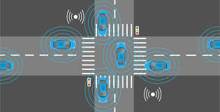
In a report published back in 2018, APWA (American Public Works Association), the company that chapters across North America, found five essential Public Works Improvements Through Technology trends that also applies to the utility providers within the same environment. Some of the trends that had been described in the report, unnamed aerial vehicles (drones) and autonomous vehicles, haven’t yet had any substantial impact on the delivery of utilities and municipal services. However, other trends are currently showing lots of promise in enhancing service delivery. Essentially, this is very true for the advanced visualization tools, whose high accuracy management capabilities and utility locating reduces the time and cost that municipalities expand on infrastructure maintenance. Some of the trends that are key when it comes to technological advancements include:
- Telematics
- Advanced field services tools
- Geographic information systems
- Advanced asset management
- Public interface (Apps, Social Media, and Web Presence)
Telematics
Telematics is a part of Public Works Improvements Through Technology which can be utilized to encompass the global positioning systems (GPS), telematics themselves, comprises of a series of sensors and measurement devices linked to the fleets of vehicles used in utility operations and municipal works. The data produced by these sensors can be utilized by managers together with the AVL and GPS data to enhance the efficiency and use of fleets of trucks and other high-level equipment like cherry pickers and snowplows. The data can quickly identify overused and underused equipment and vehicles and, thereafter, do away with all the unnecessary maintenance works by establishing scheduled maintenance on real use instead of time.
Highly Advanced Field Service Tools
When it comes to municipalities, maintaining utility infrastructure is one of the highly challenging areas of work. Although the GIS has been critical in keeping a watchful eye and safely gain access to the underground utility infrastructure, there is an increased need for the tools that allow locators to precisely visualize the complicated maze under their feet.
Innovative technologies such as vGIS are showcasing that if complimented through the augmented reality (AR), the GIS data can change the street level operations of utility providers and municipal authorities. While data visualization is a very crucial part of the GIS system from the start, this vGIS system also adds newer detail levels and usability to the GIS information visual representation. Utilizing the holographic headsets (windows, android, or iOS, tablets, and smartphones) the vGIS creates the augmented reality display a real-time image for the physical job site. They enable the users to determine the precise location for the electricity cables, gas lines, water pipes, and underground sewage systems. Also, users will be able to see the overhead cable systems where the actual outlook of this is blocked.
With additional research showcasing its efficiency-boosting and time-saving capabilities, the GIS powered AR demonstrates lots of potential to enhance the management of municipality utility assets. By allowing users to precisely and quickly plan excavations, reduce the effect on pedestrian and vehicle traffic, keep off the accidental line cuts, and enhance worker safety. Making the most common challenges for public works significantly reduced or eliminated. Senior planners and engineers can utilize the AR to get a highly intuitive overview of complex and large worksites, changing between the bird’s eye view of the entire site to the ground level AR view. The great news is that the view can also be shared with the office support teams, allowing managers to monitor different work sites closely.
Geographic Information Systems
Because of the sophisticated, time-sensitive, and wide-ranging services delivered by utility providers and municipal authorities, neither telematics or asset management will have a substantial benefit to companies without the extensive data acquired via data geographic information systems. It is for this reason that the APWA report mentioned GIS as the most vital technological trend when it comes to public works.
Accessibility to the GIS permits the users to obtain, store, modify, analyze, manage, and present geographic or spatial data.
Although in the past, utility workers, front line municipal workers, planners, and managers have communicated independently, GIS now allows them to combine and share a wide array of data sets and overlay them on the maps on the scale from the individual street to an entire municipality. A wide range of data is available, from human populations, the structure of underground cable and pipe systems, and geological composition, that typically means that the GIS is utilized in different municipal departments, from planning to education, utilities, and public works. The GIS can also be easily integrated into the city’s government or the utility’s organizations other computer systems, so that purchasing, crisis management, budgeting, maintenance, planning, and management can be perfectly informed through detailed spatial and geographic data. That has a measurable and significant impact on efficiency and assists, errors in making decisions.
Advanced Asset Management
While this is not the technology in itself, the management of assets increasingly depends on computer hardware and software to support the highly trained experts and also maximize its efficiency. The most recent software packages can assist in simplifying the highly complex tasks of complicated municipal asset management. Allowing managers to only focus on high-end decision making by automating all the necessary data analysis and production of work orders for repairs and maintenance. Investing in the hardware and software used to produce useable data and the appropriate training can play a significant role in reducing the total costs of managing assets through efficiency improvement and the elimination of expensive errors.
Public interface: (Apps, Social Media, and Web Presence)
We all understand the wide range of apps that we can easily download on either computers or mobile devices, from candy crush to Waze. When it comes to municipalities, the app can be quite simple, but also a powerful technology, creating some excellent outcomes. For instance, if you consider the “311” app now utilized in almost all American cities. A great example is Boston, which has a good model. During the spring, as the snow starts melting away, the increasing number of potholes that are created by the snowplows throughout the winter period starts to become an issue. If a person residing in Boston finds a pothole that needs repair, they only have to click on the “New Report” tab. Here you will find a list of all the common issues. Then simply take the picture via your phone and upload it, and you will find that the GPS narrows down to the exact location of where your spot is. The next tap creates the time-stamped report, immediately classifying, labeling, logging, and then send it to the municipal service responder.

It can then be tracked from that point forward by the person who filed that report. The good thing is that the pothole will get fixed, going a long way in proving the effectiveness of the applications in regards to a public service management tool. One important note is that the app did not just notify you of an existing pothole that needs filling. Instead, it filled what is often considered a void in the municipal authorities, including trust, empowerment, citizen engagement, and accountability to the public.
There is no doubt that social media can be a great source of valuable data for urban planners to collect information. As of now, almost half of America’s population lives in urban areas. Considering the number keeps growing, municipality authorities need to plan. Essentially, they must be able to plan transport networks and other developments. The posts that are submitted through Instagram, Facebook, Twitter, and other popular social media platforms are geo-tagged frequently. That can prove to be very useful to the planners that use the data to determine how these public resources are used. Although not all the details are helpful, there is a lot of useful information that you can be, like social polls, to determine the publics’ reaction to newly proposed projects. Also, unlike other sources like mobile data for example, the information acquired here is less problematic when it comes to privacy. As long as the posts are accessible by the public, collecting the data from them should not raise concerns.
There are different ways through which municipalities can benefit from social data and Public Works Improvements through Technology. The social media platforms outlined earlier are referred to as Location-Based Social Network (LBSN). Each of these platforms providers’ users has a chance to include information about their location in their conversations and posts. For instance, social data have already been used to understand land use in different major metropolitan areas, including Madrid, Manhattan, and London. Depending on the aggregated and evaluated check-ins, researchers can classify land utilized for residential activities, nightlife, daytime leisure, and business activities.
Public Works Improvements Through Technology
As a trend, the challenges of the technology-focused service that are facing municipalities are highly likely to be overcome in the coming days. Industry watchers will, without a doubt, expect to continue seeing innovative users for the new and existing technologies, as showcased by the vGIS integration of cost-effective, user-driven technologies with the preexisting professional-level systems and software to assist municipalities in enduring the perennial challenges. Public Works Improvements Through Technology represent the chance for municipalities to create significant productivity and efficiency gains and substantially enhance service delivery to all consumers.
Free Estimations
Please Reach Out with any questions
See How Your Community Can Benefit From Our Help.